

- March 1, 2018
- Posted by: Cemal Sert
- Category: All About Turkey
Turkey is exceptional due to its unique geographic position as it is situated partly in Asia and partly in Europe. Most of the country is in Asia, including the oblong peninsula of Asia Minor which is also known as Anatolia. The European part of the country is called Thrace. It is bordered to the northwest by Greece and Bulgaria, to the east by the former USSR (Georgia, Armenia, and Azerbaican Republics) and Iran, and to the south by Iraq and Syria.
Located at the crossroads of the Balkans, Caucasus, Middle East and the eastern Mediterranean, Turkey is one of the larger countries in terms of territory and population.
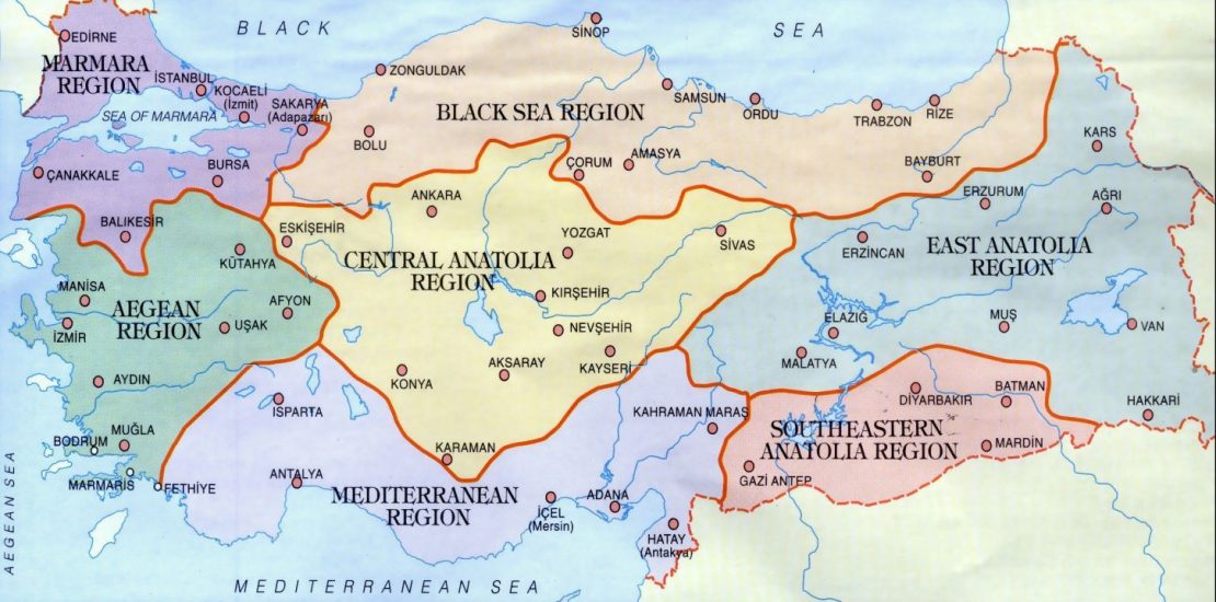
The Turkish peninsula is surrounded by four seas: the Mediterranean to the south, the Aegean to the west, the Sea of Marmara between the European and Asian land masses, and the Black Sea to the north. The entire coastline spans more than 8,000 kilometers (approximately 5,000 miles) in length.
Turkey is a predominantly mountainous country with the lowlands being confined to the coastal areas. Mount Ararat is the highest mountain standing at 16,945 feet and there are seven geographical and administrative regions – Marmara, Aegean, Mediterranean, Black Sea, Central Anatolia, East Anatolia and Southeastern Anatolia.
Due to the size of the country when you come to visit it is good to get to know Turkey’s regions and enjoy the diversity of experiences you can have in each.
Leave a Reply
You must be logged in to post a comment.